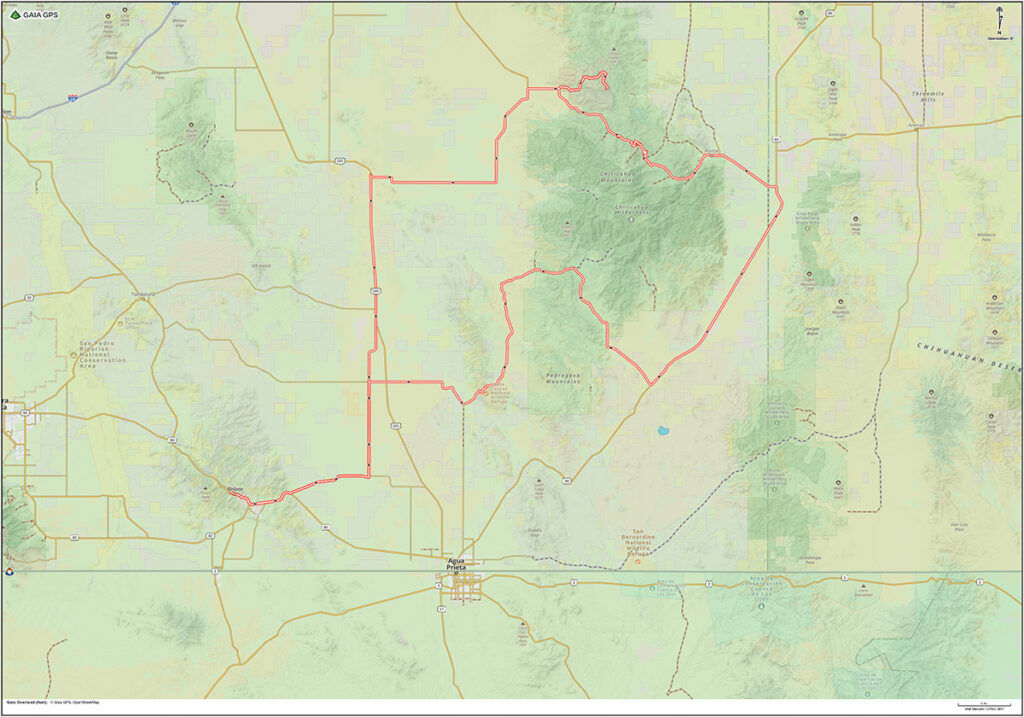
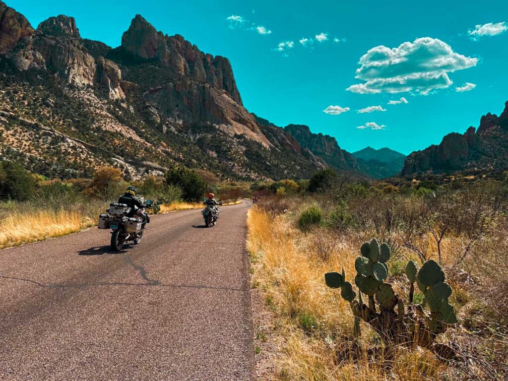
This big loop takes you east into the Chiricahua Mountains, a spectacular part of Southeastern Arizona.
Details
- Location: Starts and ends at The Jonquil Motel in Bisbee, Arizona
- Distance: 213 mile loop
- Gas: Bisbee, McNeal, Sunizona, Elfrida
- Difficulty: Easy/Intermediate
- Road Surface: paved, gravel, loose rocks, steep hills, elevation gain
- Time: full-day
- Seasonal road closures on high elevation pass
- Google Map: View Here
- Connects to: XC-High Lonesome
Highlights
- Leslie Canyon
- Rucker Canyon
- Rodeo, NM
- Chiricahua Desert Museum
- Sky Islands Grill & Grocery
- Portal Store Cafe & Lodge
- Portal, AZ
- Cave Creek Road
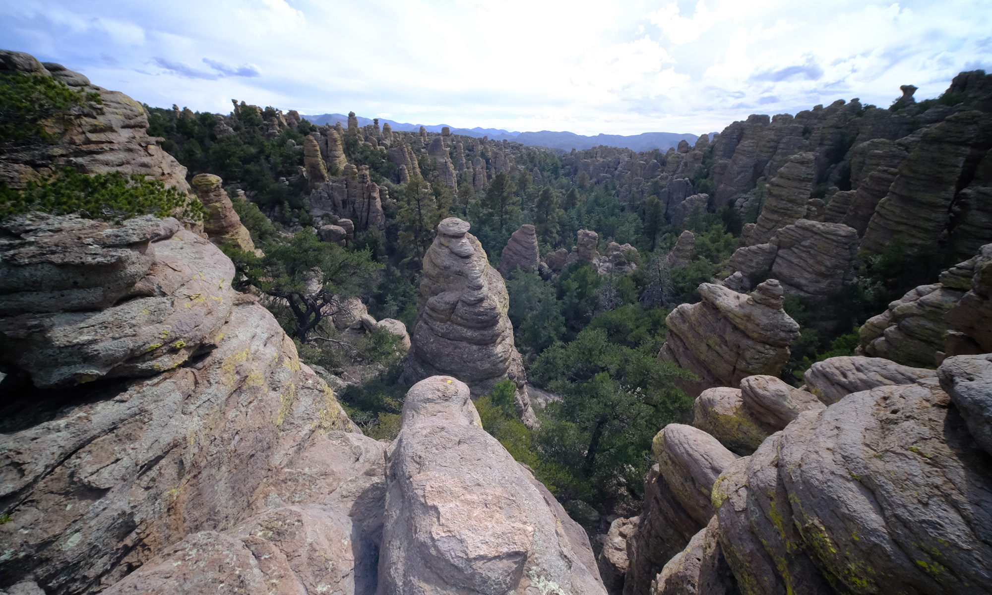
- Chiricahua National Monument
Waypoints
- Start – Circle K Bisbee – 0 miles
- POI – Lavender Pit – 1 mile
- POI – Erie Street – 2 miles
- Gas – McNeil – 24 miles
- POI – Leslie Canyon – 37 miles
- POI – Rucker Canyon – 53 miles
- POI – Geronimo Surrender Monument – 82 miles
- FB – Sky Islands Grill – 96 miles
- FB – Portal Cafe – 103 miles
- POI – Onion Saddle – 116 miles
- POI – Visitor Center Chiricahua NM – 130 miles
- POI – Massai Point – 135 miles
- POI – Jonny Ringo Grave (just off track) – 157 miles
- Gas – Sunizona – 169 miles
- Gas – Elfrida – 182 miles
- POI – Whitewater Draw (just off track) – 191 miles
- Start – XC High Lonesome – 207 miles
- End – Circle K Bisbee – 214 miles
Chiricahua Mountains | Arizona
Directions
Leave Bisbee on Highway 80 heading east toward Douglas, Arizona. Turn left on Double Adobe Road and ride across the flat desert to North Central Highway. Turn left (north) on North Central Highway. Turn right on Davis Road and follow the track as it takes you into Leslie Canyon and then Rucker Canyon. Ride adventurous dirt roads through the mountains until you come out at US Highway 80. Turn left and head north on US 80 (into New Mexico) past Rodeo, NM and then turn left on Portal Road near the Chiricahua Desert Museum (back in Arizona). Pass Sky Islands Grill and Grocery before arriving at Portal Store Cafe & Lodge in Portal, AZ. This is a great lunch stop. Travel west on Cave Creek Road as you begin climbing into the magnificent Chiricahua Mountains. Notice the rock formations near the entrance to the mountains, reminiscent of Yosemite Valley in California. The road turns to dirt as you ascend the mountains up to Onion Saddle, the high point of the road across the mountains. Descend the west side of the mountains on Pinery Canyon Road. Turn right on Bonita Canyon Drive to travel into the splendid Chiricahua National Monument. A paved road leads up to the Visitors Center and Massai Point Trailhead which is a great place to stop and admire the beauty of these unusual mountains. Leave the National Monument and return to Highway 181 South and other paved roads back to Bisbee.